Tag Archives for " Garmin "
12,000 Mile Journey: Wisconsin to Brazil and Back in a Homebuilt Aircraft
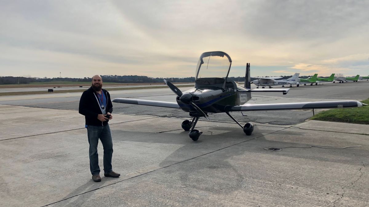
Guil Barros was browsing the Aeromart at AirVenture Oshkosh, an annual U.S. gathering of aviation enthusiasts, when he spotted an RV-9A tail and empennage kit in a caged off area. Three years and about 2,500 after-work and weekend hours later, he had himself a fully built aircraft.
Barros works in computer technology, and prior to building
his own aircraft, had logged about 40 flight hours a year as a hobby aviator in
his older 172. He didn’t necessarily consider himself a serious aviator, and
certainly not a plane builder.
But suddenly Barros was the owner of that RV-9A kit — and
filled with the determination to eventually fly it for real.
“It’s a huge project, right?” he said. “It seems
insurmountable. When you start, there’s about 15,000 rivets, which means you
have to drill out about 15,000 holes, you have to deburr about 15,000 holes,
you have to prime hundreds of parts, you have to deburr hundreds of parts.”
To maintain motivation, and maybe a little bit of sanity,
Barros just took it day-by-day, tackling small tasks each day.
“It’s just about managing a big project and managing your
expectations for what you’re going to get out of it every week,” he said.
Fortunately, Barros is a part of a large experimental aviation community. He had plenty of experts and fellow aircraft builders, including Garmin Team X, to lean on. And throughout the process, Barros had airplane mechanic friends come and look over the airplane.
“I wanted as many people as possible to look at the airplane
before I flew it,” he said. “I told them, ‘You’re not going to hurt my feelings
if you find a problem with it.’”
Once it was fully built, a Federal Aviation Administration
official inspected the aircraft, which was followed by a 40-hour flight test
period within a limited area. By the end of that test period, Barros was having
some serious fun in his new airplane. He spent the next 18 months flying it
wherever he could.
Eventually, Barros felt ready for a serious trip. While
Alaska was tempting, Barros spent the first 19 years of his life in Rio de
Janeiro, Brazil. He felt strongly that a return to his homeland and family
would be the most meaningful trip he could take after all those years building an
aircraft that could take him there.
Planning the trip — including building a route and itinerary, planning out fuel stops, getting approvals, researching lodging options in the various countries, and packing and prepping equipment — overtook his after-work and weekend time that was once spent building his airplane.

2020 Takeoff
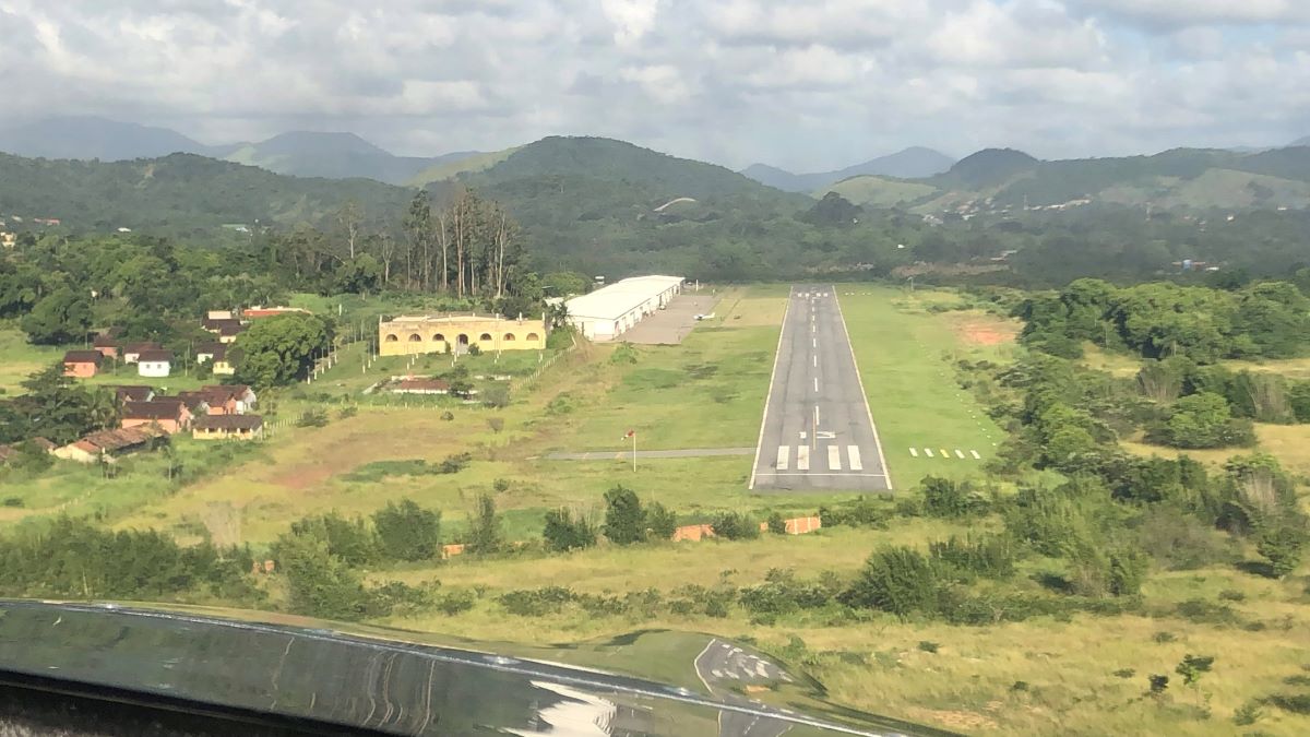
Finally, in early 2020, Barros and his wife took off from the
Madison, Wisconsin, airport. They flew south to Florida, headed east towards
The Bahamas, the Dominican Republic, Puerto Rico and Antigua, and then south along
the French island chain of the Caribbean — touching down to fuel up and spend time exploring
each destination.
Finally, a little over a week in, they reached South
America.
The trip had been fairly straightforward through that point, but South America doesn’t have as much general aviation, so it took time to obtain approvals and airport and weather information. That’s where his inReach® satellite communicator came in handy.
“It was a lot of planning and a lot of keeping our eye on what the weather looked like,” Barros said. “I think that was where the inReach Mini really, really shined. I don’t think I would ever do a trip like this without being able to communicate with the ground.”
Throughout the flight, Barros used the inReach to
communicate via two-way text with airport officials and pilot friends on the
ground.
“We were getting messages on the inReach throughout the
flight about weather reporting and conditions,” he said. “Or they would tell us
‘Hey, the weather here is not great, why don’t you continue to this next
airport that’s only another hour away, and we’ve already called them to check
that there’s fuel there waiting for you.’ It made a stressful and detailed
planning situation significantly easier.”
They also had the inReach tracking their trip and sending track points to their live MapShare page so friends, family members, fans and the media could follow along.
“We had a lot of people watching the trip,” he said.
Highlights from
12,000 Miles
It certainly was a trip of a lifetime for Barros and his
wife. They relished the new sights of his homeland from a bird’s-eye view, such
as flying over the Amazon River.
“That was absolutely gorgeous,” he said. “Green — so many different tones of
green. Seeing the hills and the rivers from above was just incredible.”
They also enjoyed their stops at some of the smaller, lesser-known
airports along the way, like the one that was within the Amazon rainforest.
“You’re suddenly in the rainforest, right?” he said. “It’s
like you’re in a movie. You’re in a gorgeous forest with these animals and
these birds that you only see on TV. It was incredible.”
Barros was charmed by the people he met along the way, too,
who offered space in hangars, places to stay the night and dinners at local
flying clubs.
One airport in Brazil had a more complicated runway than he was used to. It was a little shorter and tighter, with surrounding hills, and he felt apprehensive about flying in and out. But while touring the area, Barros got to chatting with a man who turned out to be a flight instructor.
“He said, ‘Let’s go – we’re going to get you comfortable,’”
Barros said. “So we hopped in an airplane and spent a couple of hours just
practicing getting familiar with that airport.”
And when he finally touched down in Rio, Barros was met with
a crowd of people and fanfare.
“The story that the news put out was about the wayward son
of Brazil coming back in his homebuilt aircraft,” Barros said, laughing. “They
were excited about it.”
On his way back, Barros opted to fly along the coast of
Brazil.
“That was just one beautiful flight after another following
the eastern shore of Brazil,” he said. “The views were just of beautiful ocean
and beaches. It was phenomenal.”
Once he got back to Wisconsin, the only thing Barros could think
of to have done differently was pretty simple.
“I just wish I had done it over six months instead of one month,” he said. “There was so much to see and so many people we wanted to spend time with that we met along the way.”

Trip Takeaways
While the trip was beautiful and filled with positive
experiences, it did take immense planning and logic, both beforehand and along
the way. His biggest piece of advice? Plan ahead.
“It’s important to keep an eye on where you’re going,”
Barros said. “What is the complexity of doing this? Do the places that you’re
going usually handle general aviation? Because if they don’t, it’s going to be
more complicated.”
He also recommends that pilots be aware of where they’re
going to be flying when packing survival gear. The most nerve-wracking portion
of the Wisconsin to Rio journey for Barros was the flight from Grenada to
Georgetown, which was the longest stretch over the ocean he encountered. He and
his wife wore life jackets for the entire flight.
But, in the end, after 600 gallons of fuel, 92 hours in the air and 12,000 miles flown in his homebuilt aircraft, Barros wants other aviators to know one thing:
“It’s not difficult,” he said. “This type of trip takes planning, but it’s not hard. And, ultimately, it’s such a cool experience. So just do it.”
Learn more about Barros’ journey to Brazil and back on his YouTube, Instagram and Facebook pages.
NOTICE: To access the Iridium satellite network for live tracking and messaging, including SOS capabilities, an active satellite subscription is required. Some jurisdictions regulate or prohibit the use of satellite communications devices. It is the responsibility of the user to know and follow all applicable laws in the jurisdictions where the device is intended to be used.
The post 12,000 Mile Journey: Wisconsin to Brazil and Back in a Homebuilt Aircraft appeared first on Garmin Blog.
https://www.garmin.com/en-US/blog/aviation/wisconsin-to-brazil-homebuilt-aircraft/
Alaska Flight School Teaches Pilots to Fly in World’s Remote Areas
Don Lee, owner of Alaska Floats & Skis flight school in
Talkeetna, Alaska, has felt the ground below him shake from the pounding of thousands
of caribou hooves. He’s discovered areas so abundant with blueberry bushes, it
was impossible to sit down. He’s looked down at water thick with layers of
migrating fish.
Lee is a flight instructor with decades of experience. He
prides himself on running one of the only flight schools in the world that can
teach pilots how to land off-airport on glaciers, mountains and in water. But
Lee is also passionate about discovering untouched places in Alaska — the Last
Frontier — the vast and beautiful state he’s called home since high school.
Growing up in Minnesota, Lee knew that flying was his
calling. But when he packed up after high school and hitchhiked to Alaska to
live in the bush, becoming a pilot became a necessity more than anything. It
was the only way to get in and out.
He began with flying for lodge support in Alaska and later
branched into guiding hunters and fishermen. Lee then operated an on-demand air
service for many years. He’s flown all over the world, provided air support for
climbers on Denali, performed more than 6,500 glacier landings and gained more
than 8,500 hours in floatplanes alone (with a total airtime of more than 19,000
hours).

Glaciers, Mountains,
Water
At Alaska Floats & Skis, established in 2002, Lee and
his team of flight instructors communicate that valuable knowledge to other
pilots looking to escape to remote areas. It’s one of the few schools in the
world that teaches pilots how to maneuver a ski-plane and land on glaciers —
half of which is survival training.
“You can’t teach people how to access and land in these
incredibly remote areas without teaching them how to survive if something
happens,” Lee said. “It’s very extreme. But it’s very beautiful, pristine and
quiet out there. It’s absolutely breathtaking to go to the mountains and land
on these glaciers.”
With five floatplanes in their fleet, Alaska Floats & Skis
completes from 85 to 90 seaplane ratings a year, right off their dock on
Christiansen Lake. The course is 90% water work — how to dock, how to taxi, how
to land in rough water conditions, how to read the wind and more.
“The seaplane rating is a wonderful rating to have because
it gives you so much more access to the country,” Lee said.
The bush pilot course teaches students off-airport
techniques and how to land in rough areas such as gravel bars, mountaintops and
wilderness strips. Situated at the base of Mount Denali, pilots flying through
the mountain range can experience what it’s like to have something like 15,000
vertical feet about them and 8,000 vertical feet below, an experience that Lee
describes as “very challenging and very rewarding.”
“With the off-airport courses, what we’re really teaching is
what pilots should be thinking,” Lee said. “Is the runway long enough? Is it
hard enough? Soft enough? Which way is the wind blowing? Where’s your rising
air? Where’s your descending air? Are your passengers a liability or an asset?”

Risk vs. Reward
Lee teaches all pilots to weigh risk versus reward and avoid damaging a plane or putting themselves in danger at all costs, but he also has a safety protocol in place if something happens. That includes having an inReach® satellite communicator in each of his planes.
Using his fleet of inReach devices, Lee can track all of his
airplanes in real time, overlaid on an aeronautical chart.
“Garmin has revolutionized our safety protocol,” he said. “I
now know where every one of my airplanes are for every minute of their flight
time. Alaska is so big, and our business is so busy that it’s vital I know
where those airplanes are at all times.”
In the remote Alaskan wilderness, the majority of which
doesn’t have cellphone service, Lee and his flight instructors also use their inReach
devices to communicate.
“We have the option to text different things like ‘We need
help’ or ‘We’re having a good time, so give us another hour,’ or ‘We’re OK, but
send somebody out’,” Lee said. “That’s invaluable.”
Plus, if something does go wrong, the instructors simply
have to trigger an SOS to initiate a rescue.
“Heaven forbid something did go wrong, we could get
emergency services there immediately,” Lee said.

A Flying Experience
Over the years, Lee has built much more than just a flying
school. At Alaska Floats & Skis, it’s an experience.
Participants and their nonpilot families and friends are
invited to stay at the Alaska Floats & Skis lodge, located near
Christiansen Lake, for the duration of their flying courses. They encourage
people to socialize and enjoy the surrounding area — to explore or hike in the
nearby mountains or canoe and fish in the surrounding lakes.
There’s a big firepit and a pizza oven on site, and Lee
hosts free pizza nights twice a week (and even covers the cost of pizza and
beverages).
“We encourage camaraderie,” Lee said. “It’s kind of a flying
experience. Being here, we’re really fortunate with all of the availability for
recreation and exploration.”
And, ultimately, exploration is what he’s all about.
“To be able to go into the mountains and glaciers where it’s
so incredibly pure and expansive … ” Lee said. “It’s so invigorating.”
NOTICE: To access the Iridium satellite network for live tracking and messaging, including SOS capabilities, an active satellite subscription is required. Some jurisdictions regulate or prohibit the use of satellite communications devices. It is the responsibility of the user to know and follow all applicable laws in the jurisdictions where the device is intended to be used.
The post Alaska Flight School Teaches Pilots to Fly in World’s Remote Areas appeared first on Garmin Blog.
https://www.garmin.com/en-US/blog/outdoor/alaska-floats-and-skis/

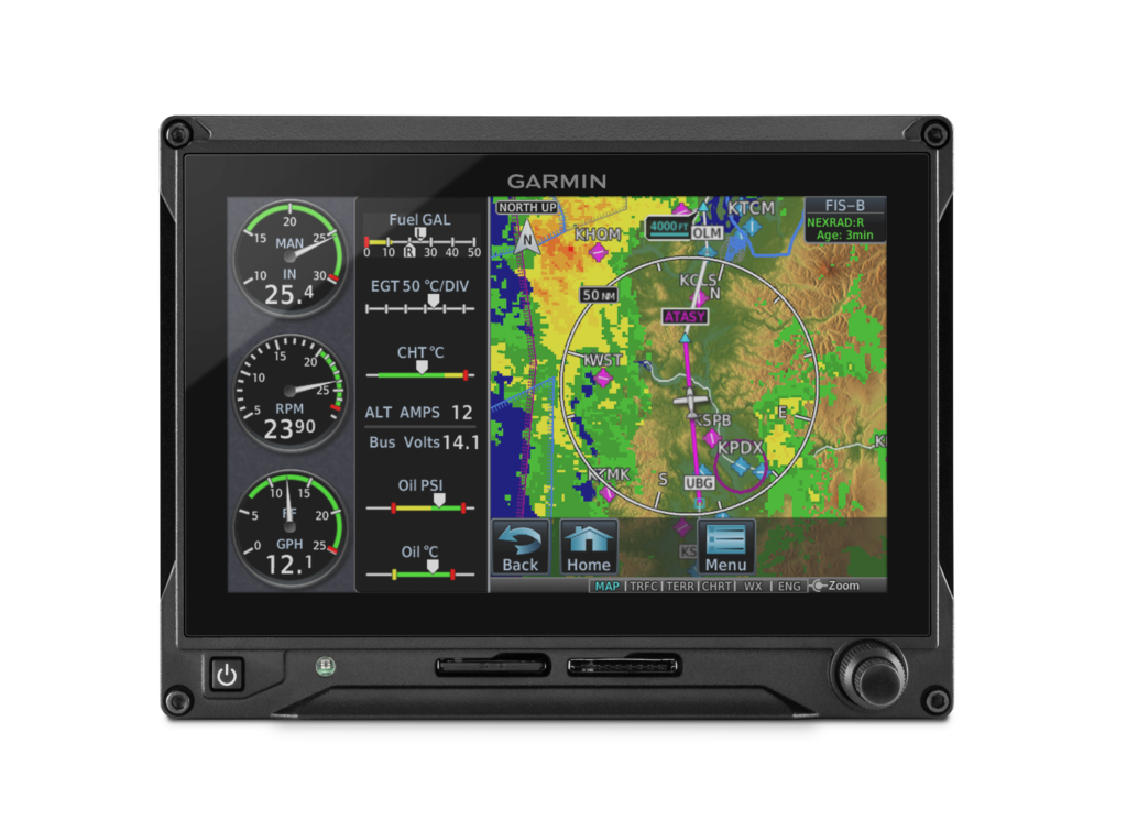
TXi Flight Displays, GTN Navigators, GFC Autopilots and G5 Electronic Flight Instrument Updates
We are adding significant capability, more configuration options and offering greater integration throughout the GTN 650/750 touchscreen navigators, the G500 TXi/G600 TXi and G500/G600 flight displays, as well as the GFC 600 & GFC 500 autopilots. Additionally, the G5 electronic flight instrument for certificated aircraft is being approved for use as a standby instrument when paired with the G500 TXi or G500 flight displays. The GFC 500 autopilot will also be approved for installation with the G500 TXi or G500 flight displays, while the addition of descent vertical navigation (VNAV) within the GTN will aid in descent planning. With Garmin, pilots receive a seamlessly integrated cockpit that offers a more harmonious transition among avionics, which reduces pilot workload and provides a superior in-flight experience.
“The Garmin avionics ecosystem continues to provide pilots with optimized upgrade opportunities and unsurpassed capabilities within the cockpit,” said Carl Wolf, vice president of aviation marketing and sales. “We are committed to providing pilots with scalable, value-oriented solutions when selecting their panel configurations. For customers with these products currently installed, these software updates offer greater operational potential and a broader feature set than any other avionics solution on the market.”
GTN 650/750 descent vertical navigation
To assist in descent planning and energy management, pilots can take advantage of VNAV profiles throughout the enroute and terminal phases of flight within the GTN 650/750 touchscreen navigators when they’re paired with the G500 TXi/G600 TXi, G500/G600 or G5. Within the GTN, pilots can easily enter altitude constraints on the flight plan page to set-up a vertical descent profile. Pilots also experience a near-seamless transition from VNAV to an arrival and instrument approach. Once an arrival or approach is loaded and activated, the GTN automatically populates step-down altitudes or any applicable altitude restrictions. If ATC issues an unpublished altitude restriction, pilots can enter those altitudes manually into the active flight plan under the VNAV field.
As part of the VNAV profile, top of descent (TOD) and bottom of descent (BOD) values are also calculated and displayed on the moving map. As the aircraft arrives at TOD, the GTN displays a visual annunciation prompting the pilot to begin the descent. When paired with a display such as a
G500 TXi/G600 TXi, G500/G600 or G5, a vertical deviation indication (VDI) also populates on the display to provide vertical guidance for the descent. Additionally, when the GTN 650/750 series is paired with the GFC 600 or GFC 500 autopilot, pilots can select the VNAV button on the mode controller to fly a fully- coupled VNAV profile.
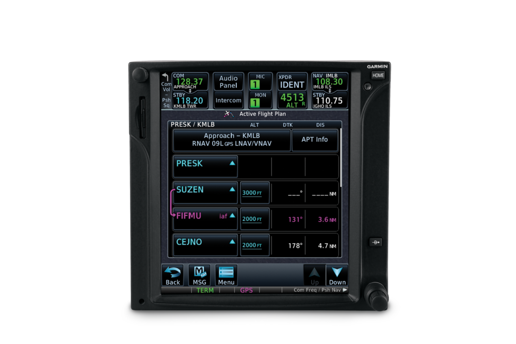
GTN 750
Approved as a standby: G5 electronic flight instrument
Our ever-popular G5 electronic flight instrument will soon be approved as a standby flight instrument when paired with the G500 TXi or G500 flight displays. In doing so, any adjustments made to heading bugs, altitude select, airspeed bugs, as well as the barometric pressure setting are automatically synced from the G500 TXi or G500 displays to the G5. Flight director and autopilot mode annunciations from the GFC 500 can also be viewed across all displays, including G5. Over 600 aircraft will be approved for the installation of G5 as a standby flight instrument alongside the G500 TXi or G500 flight displays.
GFC 500: Now approved for G500 TXi and G500-equipped aircraft
Aircraft owners can soon pair the economical GFC 500 autopilot with the G500 TXi or G500 flight displays, offering a fully-redundant, all-glass cockpit when paired with the G5. For example, in the unlikely event of a G500 TXi flight display failure, the G5 will remain coupled to the GFC 500 autopilot and continue to fly normal autopilot modes, including altitude select, heading, vertical speed and more. This compatibility significantly reduces pilot workload.
Course deviation indication (CDI) and VDI preview
A popular feature in turbine class aircraft, a CDI preview option allows pilots to view course and vertical deviation information prior to an instrument approach. When the GTN series is paired with the
G500 TXi/G600 TXi or G500/G600, pilots can view this feature within the HSI or lateral deviation indicator on the flight display. When GPS is the selected CDI source, information such as a course pointer, lateral deviation, station ID and the numeric inbound course automatically populate on the HSI in gray when an instrument approach is loaded. For ILS and GPS approaches with vertical guidance, a preview of the VDI also populates on the TXi series, G500/G600 or G5, allowing pilots to view glideslope or glidepath deviation prior to the descent.
Garmin Pilot and Engine Information System (EIS) analytics
Exclusive to Garmin, customers can now utilize Garmin Pilot on Apple mobile devices to view real-time engine information via Flight Stream 510 when the app is paired with an EIS-capable TXi flight display or the G1000 NXi integrated flight deck. Upon landing, the flight data log is wirelessly uploaded to the flyGarmin website and is stored securely within the app and on flyGarmin. Within the flyGarmin website, pilots can access detailed information related to any flight, play-back the flight and download data logs.
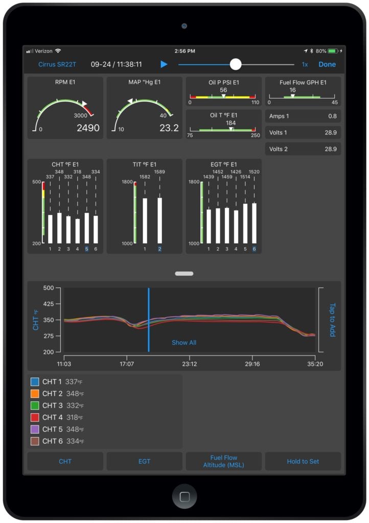
Garmin Pilot EIS on iOS
New TXi display orientations, configurations and capabilities
The TXi family adds even more options, such as:
- The 10-inch TXi flight display can be configured to a 40% PFD and 60% MFD split-screen layout.
- On a 7-inch portrait or landscape G500 TXi/G600 TXi, the displays can be configured to view moving map and single-engine information simultaneously.
- The 7-inch landscape TXi display can be used as a PFD, adding installation flexibility in aircraft panels that are space-limited.
- With a compatible camera, pilots can optionally display multiple video inputs on the MFD of a TXi display.
- Within EIS-capable TXi displays, pilots can select and view individual cylinder head temperature (CHT) values.
G500 TXi
GTN 650/750 series enhancements
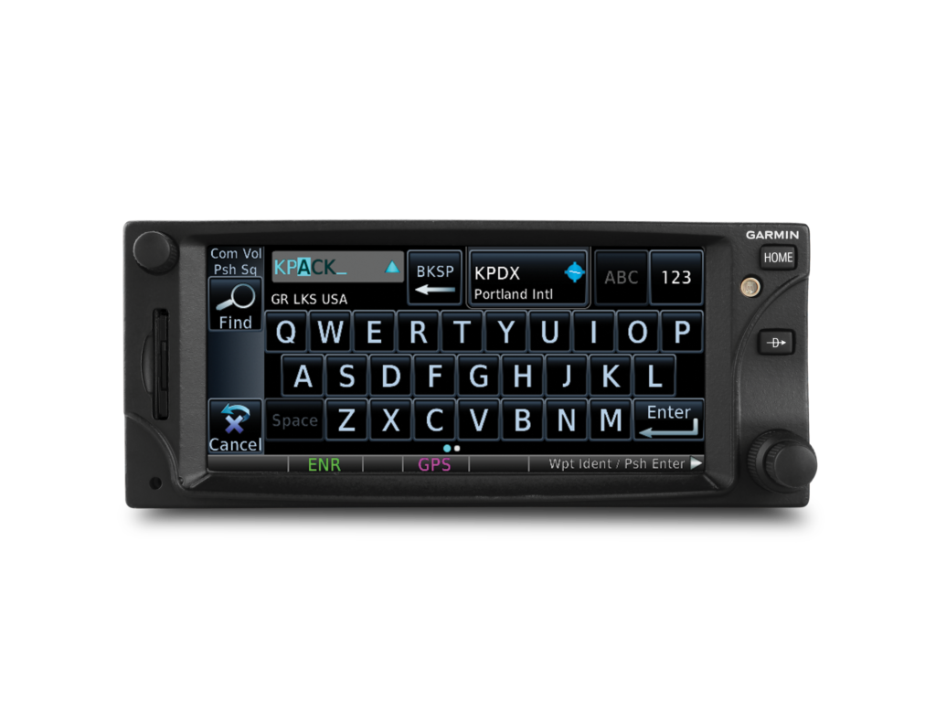
The GTN 650/750 touchscreen navigators also incorporate a variety of additional features, including:
- The addition of new audible and visual terrain proximity alerts, including, “terrain ahead, pull up”, “obstacle ahead, pull up” and “wire ahead.” An aural “five-hundred” annunciation is also available when the aircraft is on approach to land.
- Pilots can now set a user-defined waypoint as an airport so terrain alerts are minimized while landing at an airport that is not in the aviation database.
- The addition of a QWERTY keyboard within the GTN 650/750 and the G500 TXi/G600 TXi gives pilots a more familiar way to input information.
- Pilots can configure COMM sidetone settings within the GTN series.
- Irish, Swiss and English coordinate systems are now supported so it’s easier for pilots to enter GPS coordinates in various formats, including latitude/longitude, degrees/minutes/seconds and decimal degrees.
- The new GWX 75 weather radar is now supported by the GTN touchscreen navigators and the G500 TXi/G600 TXi flight displays, which offers four-times more color contouring than typically found on other weather radars on the market.
GTN 650
These software updates are available from Garmin Authorized Dealers for hundreds of aircraft makes and models, at no charge (dealer installation charge may apply). Our avionics are supported by our award-winning aviation support team, which provides 24/7 worldwide technical and warranty support. For additional information, visit www.garmin.com/aviation.

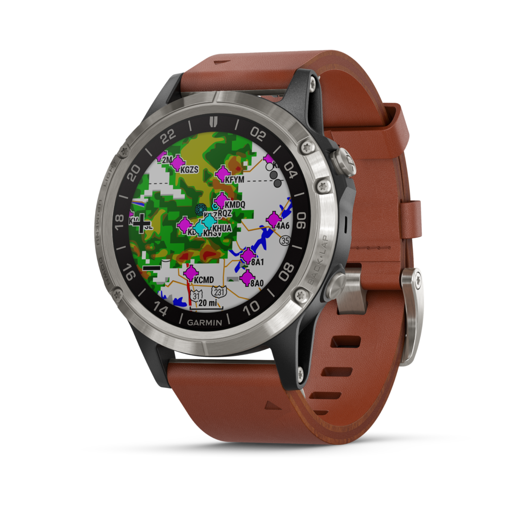
D2 Delta Series: The Latest Generation in Aviator Watches
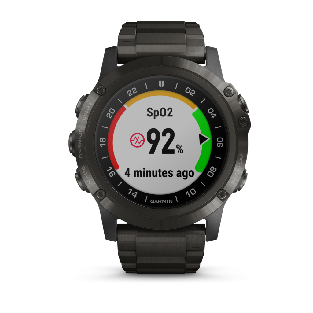
Introducing D2 Delta PX, D2 Delta S and D2 Delta aviator watch series, three new GPS-enabled smartwatches built in a variety of sizes and personalities for pilots and aviation enthusiasts. New to the D2 aviator watch series, the D2 Delta PX incorporates built-in wrist-based Pulse Oximeter for oxygen saturation awareness. Additionally, all D2 Delta watches come with wireless connectivity with select Garmin avionics, Garmin Pay contactless payment solution, storage for music playlists and more. These features offer pilots more flexibility, greater connectivity and utility in a compact aviator watch that’s as functional as it is stylish.
“The D2 Delta series merges modern style and functionality in a sophisticated watch that is available in three distinct sizes tailored to male and female pilots and aviation enthusiasts,” said Carl Wolf, vice president of aviation marketing and sales. “Whether you’re climbing into a single-pilot cockpit on the weekend, shooting instrument approaches to minimums or flying professionally, the D2 Delta transforms the aviator watch market with exclusive aviation functions and connected features that appeal to every pilot – regardless of what flying they do.”
The premium D2 Delta PX features an elegant titanium gray diamond-like carbon (DLC) finish on a large, 51mm bezel. Especially useful in-flight and during high altitude activities, the D2 Delta PX exclusively incorporates wrist-based Pulse Ox to help monitor oxygen saturation levels.
D2 Delta PX
The D2 Delta S features a stylish rose gold-tone bezel and is lighter, sleeker and smaller than previous D2 models. At 42mm, the D2 Delta S is ideal for smaller wrists and comes with a beige leather strap that makes it easy to transition from the cockpit to a night out. The third model in the series, the D2 Delta, measures 47 mm and has a silver titanium bezel, as well as a premium brown leather strap.
The D2 Delta series seamlessly integrates with select Garmin avionics to achieve a harmonious, connected cockpit. The D2 Delta can connect wirelessly to the Garmin Pilot app, as well as the
GTN 650/750 touchscreen navigator series or the G1000 NXi integrated flight deck via
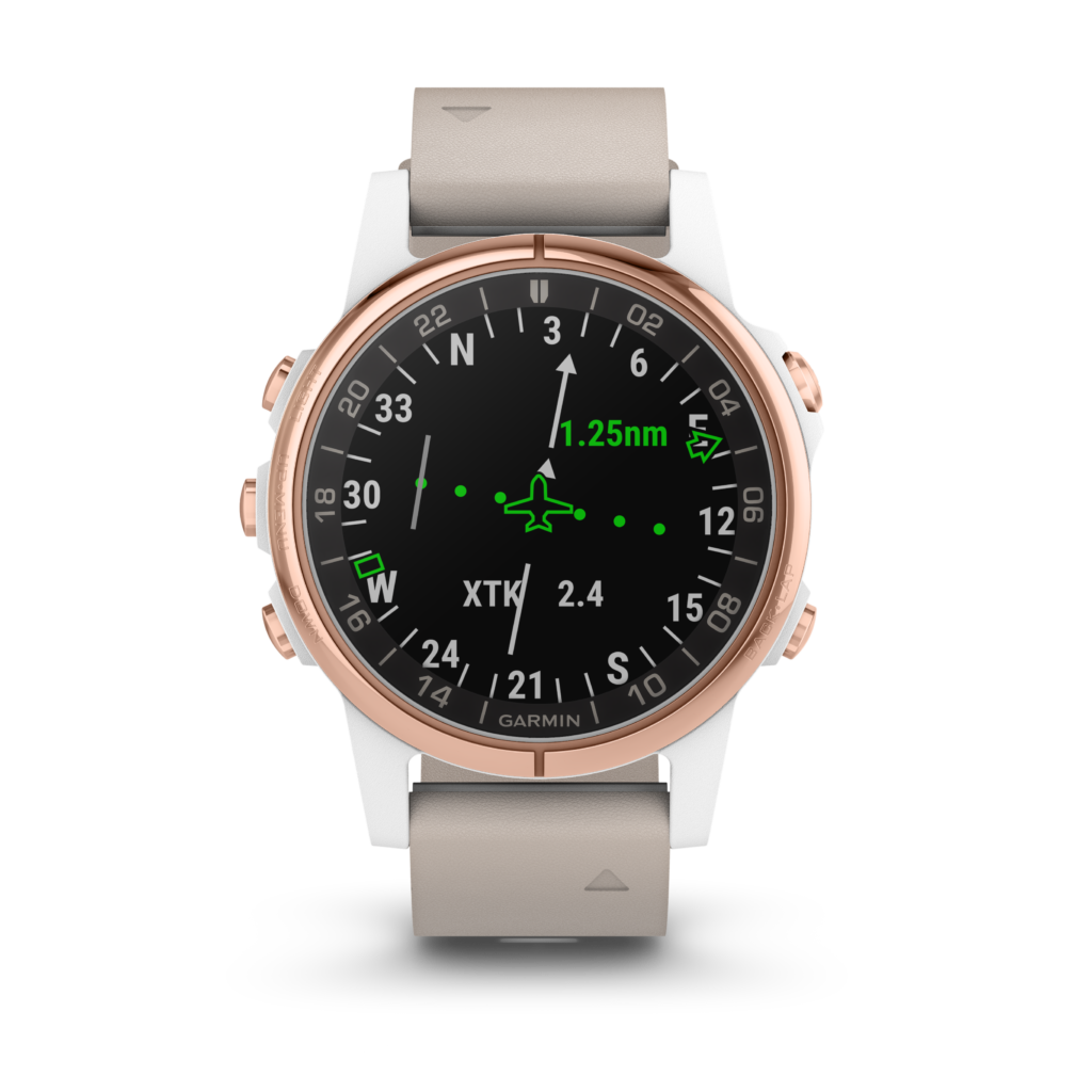
Flight Stream 510 to enable wireless flight plan transfer to the watch. When connected, all models in the new D2 Delta series can receive additional information from compatible avionics including GPS position information, altitude, airspeed, groundspeed, magnetic heading, outside air temperature and more.
D2 Delta S
Bluetooth-capable music streaming enriches every activity as all models of the D2 Delta incorporate integrated music storage of up to 500 songs within the watch, offering phone-free listening. Download playlists from select music streaming services or transfer customized playlists from a computer directly to the watch. Once the playlist is loaded, pilots can pair a D2 Delta with a compatible Bluetooth Garmin audio panel such as the GMATM 245, GMA 345 or GMA 350c. The D2 Delta can also be paired with a Bluetooth headset or headphones (sold separately).
All sizes of the D2 Delta also include Garmin Pay, a contactless payment solution, allowing customers to leave their cash and credit cards at home. Utilizing their Garmin Pay wallet, customers have the same benefits and rewards of the physical cards, with the convenience of having them available on their wrist.
D2 Delta
The D2 Delta aviator watch series also features new smartwatch alerting tailored to aviation operations. These new alerts include:
- Configurable pressure altitude notifications, which consists of a series of vibrations when arriving at a selected altitude;
- A fuel tank timer that vibrates at configurable intervals to help remind pilots to switch fuel tanks while in-flight;
- A cross track error notification, which triggers a vibrating alert when pilots deviate from an active flight plan.
The D2 Delta aviator watch series come preloaded with a full multisport toolset for running, golfing, cycling, skiing, workouts and more. It is also water rated to 100 meters so it can withstand swimming and other water activities. When paired with a compatible smartphone, users can send, receive and respond to text messages and see social media updates, app alerts, calls, emails and more via the watch. Garmin Elevate wrist-based heart rate technology also monitors heart rate 24/7 alongside daily activity tracking. Because the D2 Delta is versatile and supports a variety of activities, QuickFit bands allow users to easily switch between stylish leather and metal accessory bands to sporty silicone in seconds and without tools.
All of the new D2 Delta models come preloaded with a worldwide aviation database and incorporate signature aviation accents, dedicated direct-to and nearest airport buttons, as well as the option to input a customizable aircraft tail number on the face of the watch. A large, sunlight-readable, high-resolution color display with an LED backlight on the watch face, allows pilots to view data in most lighting conditions in the cockpit. The D2 Delta PX offers up to 18 hours of battery life in GPS and Pulse Ox mode and up to 20 days in smartwatch mode

Blue Button: Helping to Keep the Blue Side Up
Aircraft loss-of-control scenarios in-flight are one of the foremost safety concerns in aviation today. It’s become such a safety concern that it’s landed a spot on the National Transportation Safety Board’s Most Wanted List. At Garmin, we’re doing our part to help put an end to these dangerous events. And one of our tools is our “blue button.”

GMC 507 mode controller for GFC 500 digital autopilot, featuring the blue return-to-level mode button.
Officially referred to as the return-to-level (LVL) mode button, this dedicated button has been incorporated in select Garmin integrated flight decks featuring GFC 700, plus our new, cost-effective GFC 500 and GFC 600 retrofit autopilots — along with several Garmin autopilot solutions for experimental and light sport aircraft.
So, what exactly does the blue button do? In short, it puts the blue side — the sky — up. When the level mode button is activated in-flight, the autopilot automatically engages and works to return the aircraft to a straight-and-level condition.
We’ve heard the common scenarios that lead to loss of control before, including spatial disorientation from entering inadvertent IMC, from loss of situational awareness in the soup or even from steep turns. Fortunately, with our blue button, we’ve created a tool that can help.
For more information about the LVL Mode “blue button,” or to learn more about our autopilot solutions, visit our website at Garmin.com/aviation

Understanding Garmin Electronic Stability & Protection (ESP)
E-S-P. Three simple letters, with an extremely powerful meaning: Electronic Stability & Protection. It’s a feature our team designed to keep a watchful eye on an aircraft’s flight condition — and lend a helping hand if needed.
What is ESP? ESP is a safeguard created to assist you in maintaining safe, stable flight when hand-flying your aircraft. It monitors the aircraft’s flight condition, functioning independently of the autopilot, and it applies a control force toward stable flight whenever pitch or roll deviations exceed recommended limits. ESP can also recognize when underspeed or overspeed conditions are about to occur — such as a stall or too-steep of a descent — and it makes appropriate adjustments to the controls. Plus, if the system detects that ESP has been activated for a specified period of time — such as in the event of pilot incapacitation — the autopilot will engage with the flight director in level mode to bring the aircraft back to level flight. However, if you’re training or practicing, ESP can be manually disabled to allow intentional flight maneuvers.
Where is ESP? ESP can be found in many of our most popular integrated flight decks, including a number of G1000 NXi- and G3000-equipped aircraft, along with our new cost-effective GFC 500 retrofit autopilot for light single-engine aircraft, and GFC 600 retrofit autopilot for high-performance, more complex aircraft. Experimental/LSA owners and pilots can also take advantage of ESP with our G3X and G3X Touch experimental flight display systems by utilizing compatible G3X autopilot servos.
How can ESP help? Lately, an important discussion within the aviation community has centered around aircraft loss-of-control scenarios—in fact, it’s on the NTSB’s “Most Wanted” list. ESP is a direct result of these conversations. By helping to avoid the onset of inadvertent stall/spins, steep spirals or other loss-of-control situations, we want to help make the flight environment even better.
For more information about ESP, plus our extensive line of aviation products, visit our website at garmin.com/aviation.